Resources

Radar & Forecast Tools

A practical, beginner-friendly guide to the tools storm chasers use to monitor storms in real time—plus what each product is best for and what to watch out for.

Doppler radar dome against a blue sky
Core tools

Your “daily driver” toolkit

These three categories cover most real-world chasing decisions: where storms are, what they’re doing now, and what they’re likely to do next.

Radar display showing storm cells

Radar (reflectivity + velocity)

Use radar to track storm structure, intensity trends, and rotation signatures. Learn the basics of tilts, storm-relative motion, and how beam height changes with distance.

What to look for
Weather station instruments under a cloudy sky

Surface observations (METARs + mesonets)

Ground truth for temperature, dew point, wind shifts, pressure falls, and boundaries. Great for locating drylines, outflow, and warm fronts.

How to use it
Thunderstorm over a desert landscape

Forecast models + guidance

Use short-range models and official outlooks to plan target areas and timing. Focus on trends and consistency, not one “perfect” run.

Common pitfalls
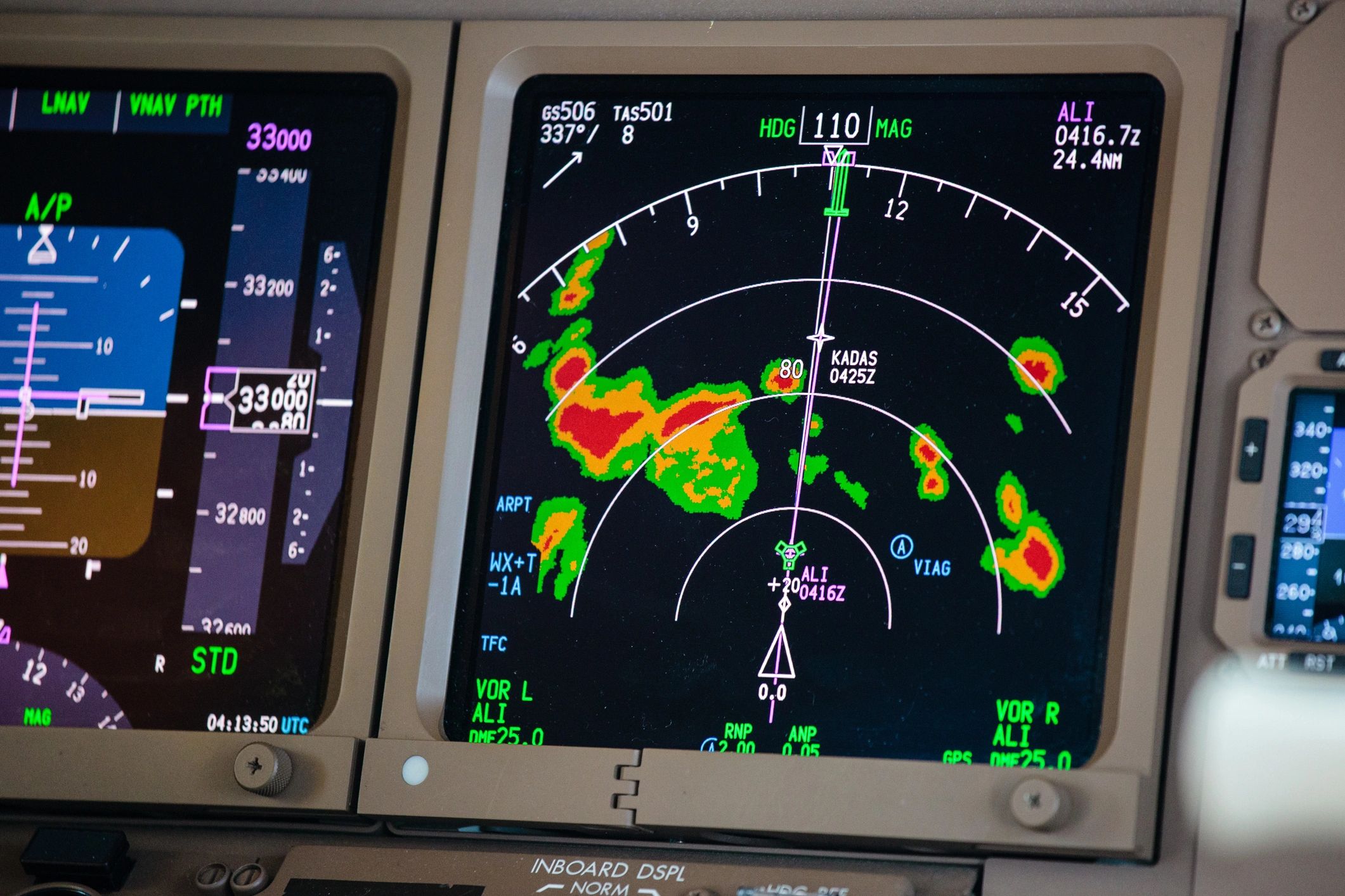
How to read radar safely

Make better decisions with fewer surprises

Radar is powerful—but it’s not a windshield. Use it to anticipate hazards, not to justify risky positioning.

Know what radar can’t see

Beam height increases with distance, and low-level features can be missed far from the site. Treat “no return” as “unknown,” especially at long range.

Use velocity with context

Rotation signatures can be noisy. Compare multiple tilts, check storm motion, and look for persistence before assuming a tornado threat.

Doppler radar dome
Quick answers

Radar & forecast FAQ

Common questions newcomers ask when they start using radar and guidance products.

Learn storm structure