Wiki • Storm Structure
Storm types you’ll see while chasing
A practical overview of common convective storm modes—what they look like, what hazards they produce, and why they matter for safe decisions in the field.
Common storm modes (quick reference)
Use this as a starting point. Real storms can evolve from one mode to another as the environment changes.
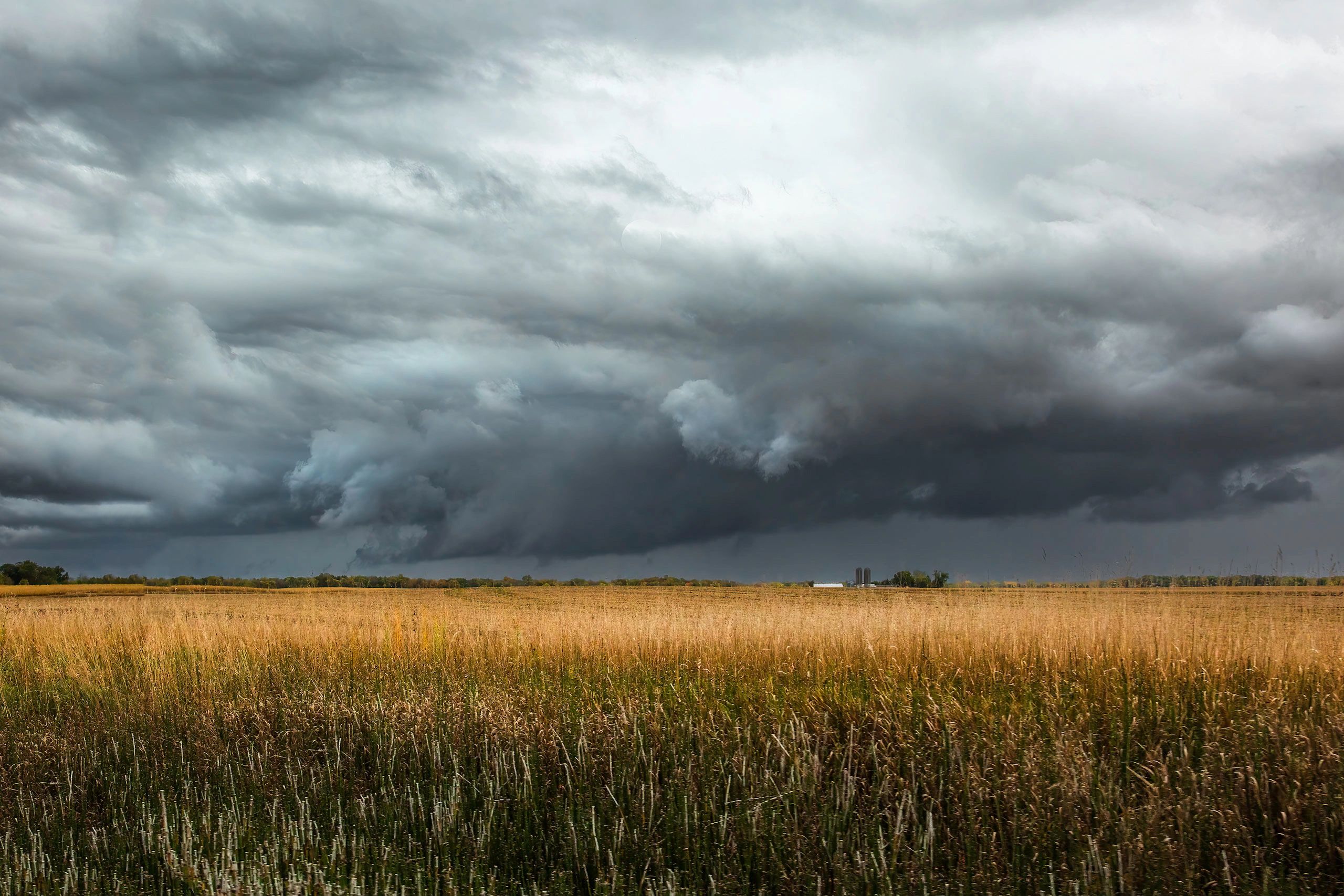
Single-cell (pulse) storm
Short-lived updrafts that pop up and collapse quickly. Watch for brief heavy rain, small hail, and sudden wind.
Multicell cluster
A group of cells at different life stages. Hazards often come from outflow winds and repeated heavy rain.
Multicell line / squall line
A line of storms along a boundary. Expect widespread straight-line wind, frequent lightning, and fast-changing road options.
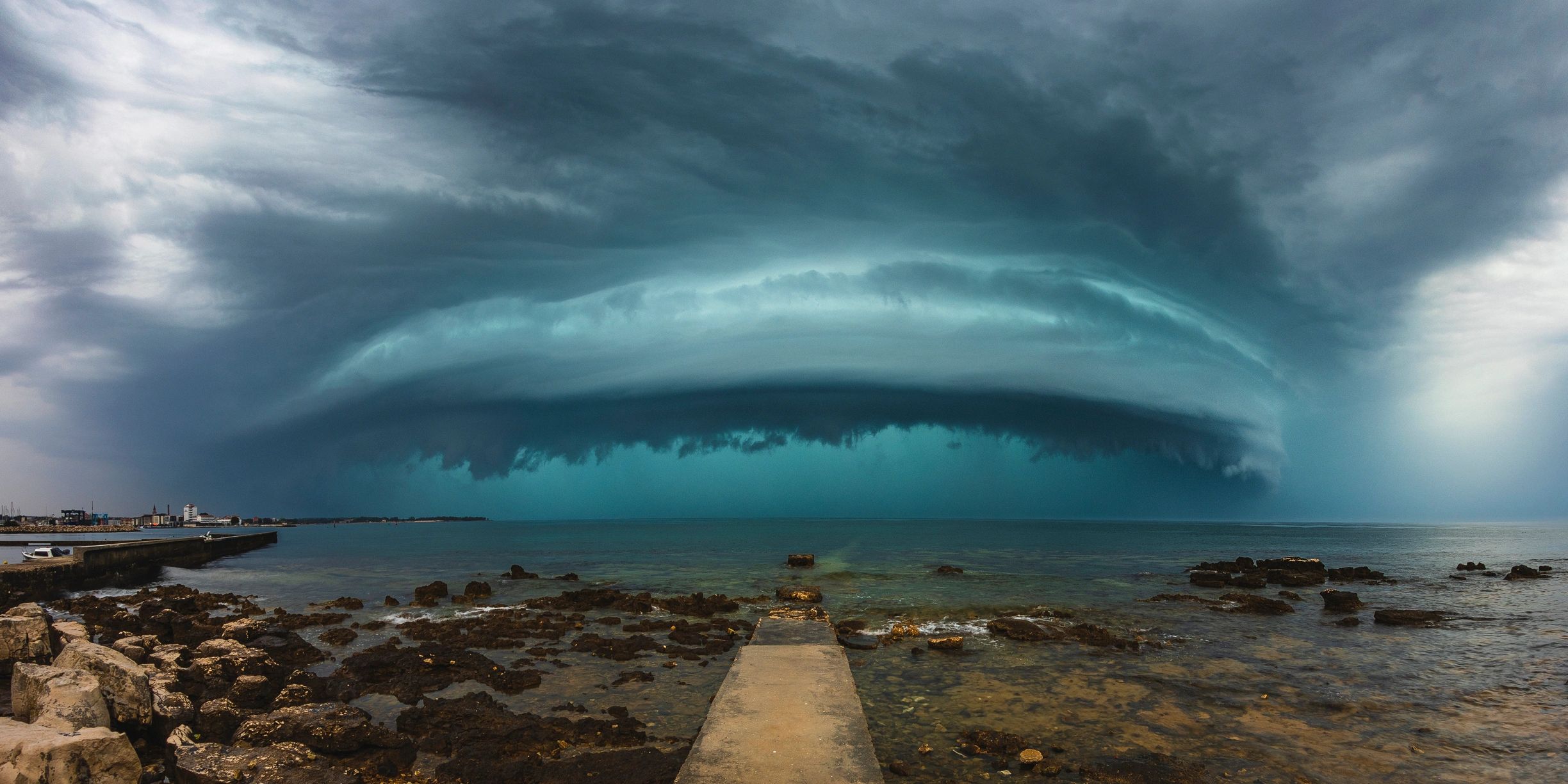
Supercell
A rotating storm with a persistent updraft. Higher potential for large hail, damaging wind, and tornadoes.
HP / Classic / LP supercells
Supercell “flavors” based on precipitation and structure. Visibility and hail risk vary a lot by type.

MCS / bow echo
Organized nighttime complexes and bowing segments. Long-lived wind damage and flash flooding can be the main threats.
How to identify
What to look for (structure + radar cues)
Pair visual structure with radar trends. If you’re unsure, default to a conservative position and prioritize escape routes.
Boundaries & inflow
Look for a sharp temperature/dewpoint change, wind shift, or a visible boundary. Strong, warm inflow feeding a dominant updraft often signals more organized storms.
Updraft base & precipitation core
A smooth, persistent base with a separated rain/hail core can indicate supercell structure. A messy, rain-wrapped look can hide hazards and reduce visibility.
Outflow & gust fronts
Shelf clouds and surging outflow can rapidly change storm motion and road options. Treat strong outflow as a wind hazard and a visibility hazard (blowing dust/rain).
Radar trends
Watch for cell mergers, strengthening cores, and persistent rotation signatures. Rapid upscale growth can turn a “one storm” chase into a line with limited safe approaches.
Storm-type FAQs
Quick answers to common questions newcomers ask when learning storm modes.
Can a storm change types during the chase?
Yes. A discrete storm can merge into a cluster, a cluster can organize into a line, and supercells can transition between LP/classic/HP depending on moisture, shear, and interactions.
Which storm type is “best” to chase?
There’s no universal best. Discrete storms can be easier to observe, but any mode can be dangerous. Choose targets based on safety, road network, daylight, and your experience.
What’s the biggest hazard in lines and MCS events?
Widespread straight-line wind and fast storm motion. Add frequent lightning and heavy rain, and it’s easy to get boxed in—especially at night.
Do all supercells produce tornadoes?
No. Many supercells never produce a tornado, and some produce brief or rain-wrapped tornadoes that are hard to see. Always plan for the possibility when rotation is present.
What does “HP supercell” mean for safety?
High-precipitation supercells can hide the circulation in heavy rain and have intense hail cores. Visibility drops quickly—avoid getting too close and keep a clear escape route.
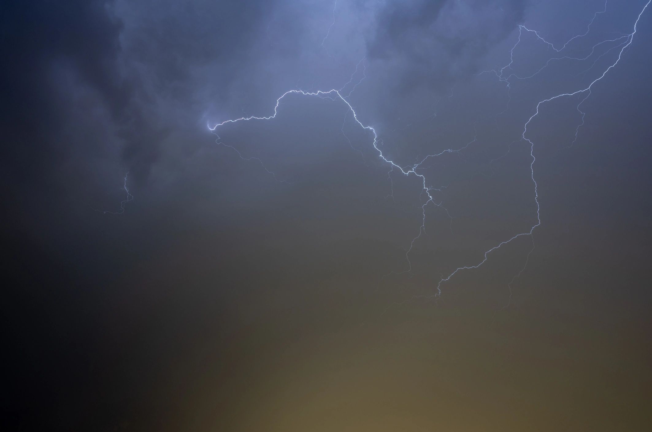
Is lightning risk different by storm type?
Any thunderstorm can produce dangerous cloud-to-ground lightning, even away from the main core. If you can hear thunder, you’re close enough to be struck.